
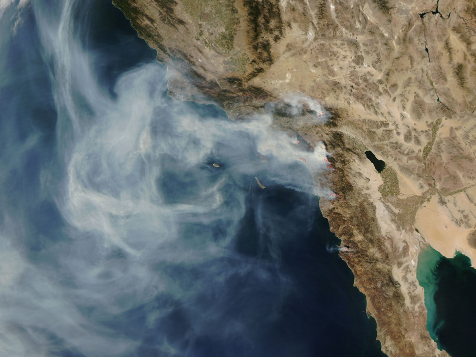
We’ve got some High Resolution Satellite images of the fires that have been burning across Southern California for the past 5 days. (Images were taken over the past two days.) As of now there have been over 900,000 forced evacuations, over 1,600 homes have been destroyed, and 500,000 acres have been burned down stretching from Santa Barbara to the Mexican Border. Many who have not yet been asked to evacuate are leaving due to the poor air quality. Both Governor Schwarzenegger and President Bush have declared a state of emergency and federal aid is being provided.
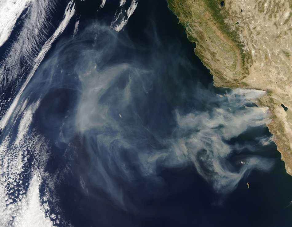

As for the images, they have been taken by NASA’s MODIS Rapid Response System. The first image at the top was taken yesterday (10/24/07) and the two images below were taken October 22nd (left) and October 23rd (right). To save server load, we’ve only placed the low resolution images in the thumbnails, however if you would like a copy of the full resolution images, save the zip file provided below.
Download: california-fires-2007.zip
Links: California Wild Fires Of October 2007 (wiki)
Related: Hurricane Katrina Satellite Images


